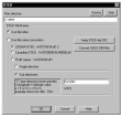
DTED Converter
by Aaron Brown
DTED Converter is an open source tool for converting Digital Terrain Elevation Data (DTED) files into other geospatial file formats.
maximum
DTED Converter is an easy-to-use, powerful software application designed to convert digital terrain elevation data (DTED) into other formats and vice versa. This application is designed to quickly and accurately convert data from one format to another, allowing users to make the most of their data and their mapping needs.
• Supports multiple DTED formats such as Level 0, 1, 2, and 3.
• Ability to convert between different DTED formats.
• Ability to convert to/from other formats such as GeoTIFF and ArcGrid.
• Batch processing available, allowing users to convert multiple files at once.
• Ability to customize output settings such as interpolation and projections.
• Ability to customize resolution settings.
• Ability to customize compression settings.
• Ability to preview and analyze data before conversion.
• Ability to export data to various formats such as PDF, KML, KMZ, and more.
• Ability to create detailed reports of data analysis and conversion.
• Ability to export the converted data to a variety of formats, including vector and raster.
• Ability to customize the metadata of output files.
• User-friendly and intuitive interface.
• Works with Windows, MacOS, and Linux.
• Free and open-source.
• Comprehensive help and support available.
DTED Converter is an easy-to-use, powerful software application designed to convert digital terrain elevation data (DTED) into other formats and vice versa. This application is designed to quickly and accurately convert data from one format to another, allowing users to make the most of their data and their mapping needs.
The DTED Converter enables users to quickly and easily convert DTED files into more useful formats for analysis.Features:
• Supports multiple DTED formats such as Level 0, 1, 2, and 3.
• Ability to convert between different DTED formats.
• Ability to convert to/from other formats such as GeoTIFF and ArcGrid.
• Batch processing available, allowing users to convert multiple files at once.
• Ability to customize output settings such as interpolation and projections.
• Ability to customize resolution settings.
• Ability to customize compression settings.
• Ability to preview and analyze data before conversion.
• Ability to export data to various formats such as PDF, KML, KMZ, and more.
• Ability to create detailed reports of data analysis and conversion.
• Ability to export the converted data to a variety of formats, including vector and raster.
• Ability to customize the metadata of output files.
• User-friendly and intuitive interface.
• Works with Windows, MacOS, and Linux.
• Free and open-source.
• Comprehensive help and support available.
DTED Converter software is a data conversion program for creating Digital Terrain Elevation Data (DTED) files from other types of elevation data. The software is typically used for converting digital elevation models (DEMs) from other formats, such as GeoTIFF, into the DTED format.
Minimum System Requirements:
• Operating System: Windows 7, 8, 10, or higher
• Processor: Intel Core i3 or higher
• Memory: 4 GB RAM
• Graphics: DirectX 11 Compatible
• Hard Drive: 500 MB free space
• Input Devices: Mouse and Keyboard
• Other: Internet connection for activation
Minimum System Requirements:
• Operating System: Windows 7, 8, 10, or higher
• Processor: Intel Core i3 or higher
• Memory: 4 GB RAM
• Graphics: DirectX 11 Compatible
• Hard Drive: 500 MB free space
• Input Devices: Mouse and Keyboard
• Other: Internet connection for activation
PROS
Converts DTED files quickly and efficiently.
Offers batch conversion for multiple files.
Enhances productivity by automating tasks.
Offers batch conversion for multiple files.
Enhances productivity by automating tasks.
CONS
Lacks advanced image editing features.
The user interface can be complex for beginners.
Limited customer support options.
The user interface can be complex for beginners.
Limited customer support options.
Finn Ari
DTED Converter software is a good choice for data file conversion. It's a robust, fast and easy to use software package. The interface is intuitive and user-friendly. The conversion process is reliable and the resulting files are accurate. I especially like the fact that it supports a wide variety of input and output file formats. The software is also well-documented and has helpful tutorials to get started. It is also reasonably priced compared to other similar software packages. All in all, DTED Converter is a good choice for data file conversion.

