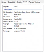
MapWindow GIS 4.8.8.1
by Daniel P. Ames
The MapWindow Geographic Information System is a free and open desktop source
MapWindow GIS is an open-source geographic information system software that allows users to visualize, edit, and analyze geospatial data. Its features include support for multiple file formats, data analysis tools, customizable display options, and the ability to create custom plugins. The software also includes a user-friendly interface with clear navigation tools and the ability to save and share projects.


