depthmapX (formerly UCL Depthmap)
by University College London
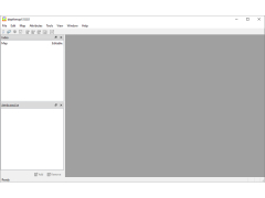
DepthmapX is a network visualization and analysis platform designed to explore the spatial structure of complex networks.
Operating system: Windows
Publisher: University College London
Antivirus check: passed
DepthmapX (formerly UCL Depthmap) is a free and open source software for spatial network analysis and network visualization. It is designed to enable users to quickly and easily visualise, analyse and explore the spatial networks of their data.
DepthmapX enables users to analyse and visualise the spatial networks of their data. It provides powerful tools that allow users to explore and interpret their data in ways that are not possible with other spatial analysis tools. The software includes the following features:
Network Visualisation: DepthmapX enables users to quickly and easily visualise the spatial networks of their data. The software includes a range of network visualisation tools, including force-directed layouts, adjacency matrices, network diagrams and network maps.
Network Analysis: DepthmapX provides a range of network analysis tools, including measures of centrality, accessibility, density, connectivity, path length and distance. These tools can be used to identify patterns and trends in the spatial networks of the data.
Data Exploration: DepthmapX enables users to explore their data in more detail. The software includes a range of interactive visualisation tools, including point-and-click exploration, panning and zooming, and data exploration.
Data Integration: DepthmapX supports the integration of multiple data types, including geospatial data, spatial networks, and other types of data. This enables users to combine multiple data sources to explore their data in more detail.
Data Export: DepthmapX enables users to export their data in a range of formats, including CSV, KML, SVG, and Shapefile. This allows users to easily share and publish their data with others.
Interactive Reports: DepthmapX provides an interactive reporting tool, which enables users to quickly and easily generate reports based on their data. The reports can be exported in a range of formats, including HTML, PDF, and Excel.
These features make DepthmapX an ideal tool for quickly and easily visualising, analysing, and exploring the spatial networks of data. The software is free and open source, and can be used for a range of applications, from basic network visualisation to advanced network analysis.
DepthmapX allows users to visualize and analyze the spatial structure of urban environments.Features:
DepthmapX enables users to analyse and visualise the spatial networks of their data. It provides powerful tools that allow users to explore and interpret their data in ways that are not possible with other spatial analysis tools. The software includes the following features:
Network Visualisation: DepthmapX enables users to quickly and easily visualise the spatial networks of their data. The software includes a range of network visualisation tools, including force-directed layouts, adjacency matrices, network diagrams and network maps.
Network Analysis: DepthmapX provides a range of network analysis tools, including measures of centrality, accessibility, density, connectivity, path length and distance. These tools can be used to identify patterns and trends in the spatial networks of the data.
Data Exploration: DepthmapX enables users to explore their data in more detail. The software includes a range of interactive visualisation tools, including point-and-click exploration, panning and zooming, and data exploration.
Data Integration: DepthmapX supports the integration of multiple data types, including geospatial data, spatial networks, and other types of data. This enables users to combine multiple data sources to explore their data in more detail.
Data Export: DepthmapX enables users to export their data in a range of formats, including CSV, KML, SVG, and Shapefile. This allows users to easily share and publish their data with others.
Interactive Reports: DepthmapX provides an interactive reporting tool, which enables users to quickly and easily generate reports based on their data. The reports can be exported in a range of formats, including HTML, PDF, and Excel.
These features make DepthmapX an ideal tool for quickly and easily visualising, analysing, and exploring the spatial networks of data. The software is free and open source, and can be used for a range of applications, from basic network visualisation to advanced network analysis.
DepthmapX is compatible with Windows 7 and later, Mac OS X 10.6 and later, and Linux Ubuntu 14.04 and later. It requires at least 4GB of RAM, a display resolution of 1024 x 768, and an OpenGL 4.1 compliant graphics card with 1GB of VRAM.
PROS
Allows easy spatial network analysis and visualization.
Free and open-source software.
Predicts pedestrian movement accurately.
Free and open-source software.
Predicts pedestrian movement accurately.
CONS
Limited to spatial network analysis, lacks broader functionality.
Steep learning curve for beginners.
Lack of comprehensive user guide or tutorials.
Steep learning curve for beginners.
Lack of comprehensive user guide or tutorials.
Alex Bilder
DepthmapX is a powerful tool for visualizing and analyzing spatial networks. It has a simple and intuitive user interface and offers a wide range of features. It is easy to use and understand. I particularly like the ability to generate network diagrams and calculate statistics. The software is regularly updated with new features and bugfixes. Overall, it is a great tool for visualizing and analyzing urban environments.


