Google Satellite Maps Downloader

Download small tile satellite images to the computer hard disk

Operating system: Windows

Release : Google Satellite Maps Downloader 8.31

Antivirus check: passed

Report a Problem

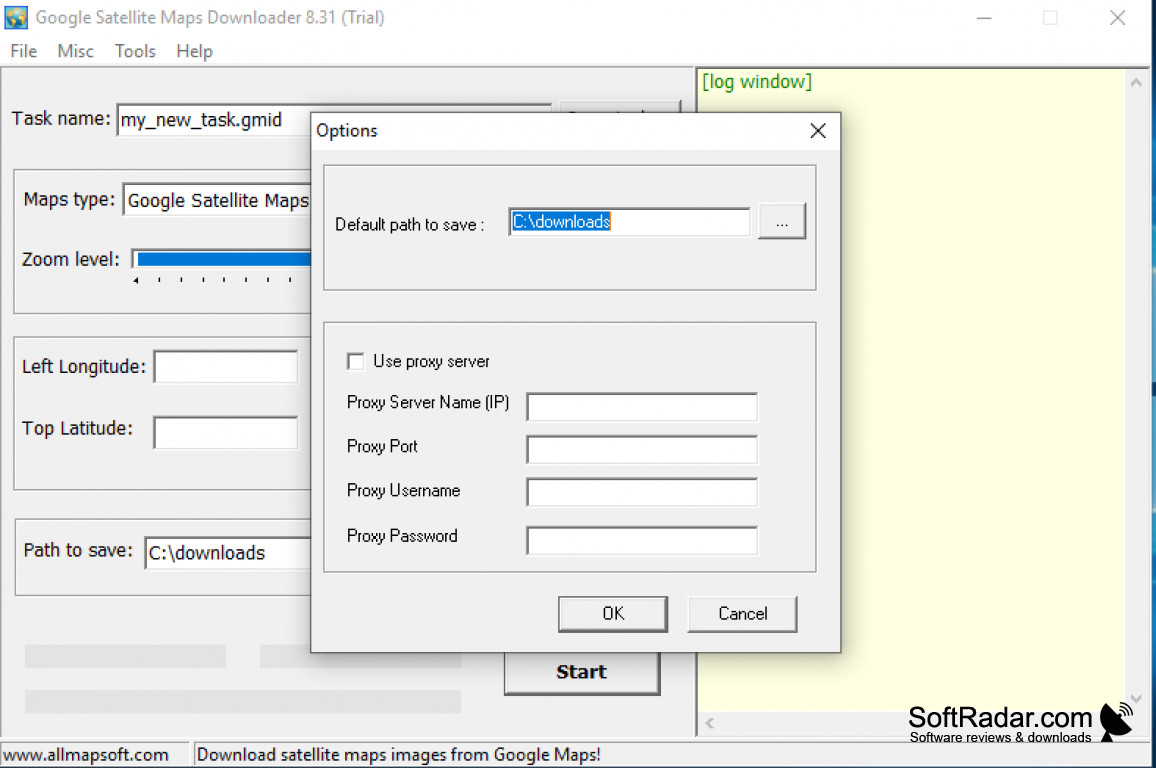
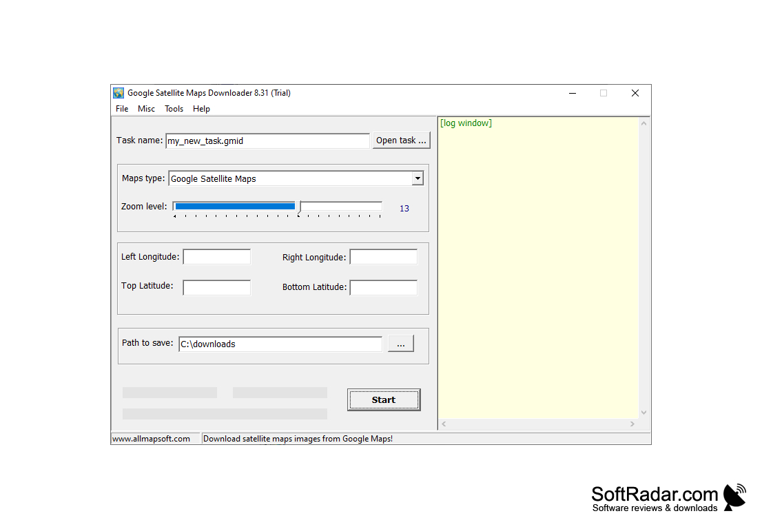
Google Satellite Maps Downloader is an innovation that allows a person to view global satellite images after their download from the google map. This Downloader program operates using the location parameters (longitudes and latitudes) to pinpoint and zoom in at the particular target area intended by converting these gradients into decimal degrees.

Features:

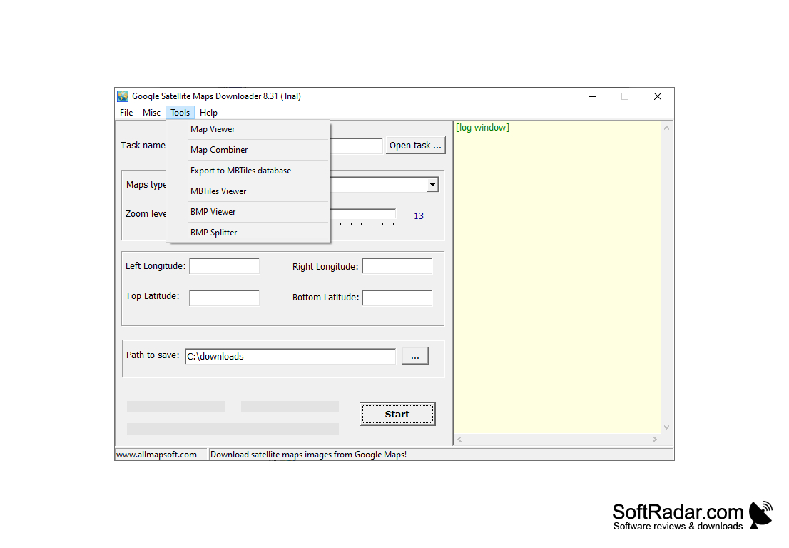
  • Assembles files into bitmaps
  • Provides satellite image viewer
  • Built-in browser
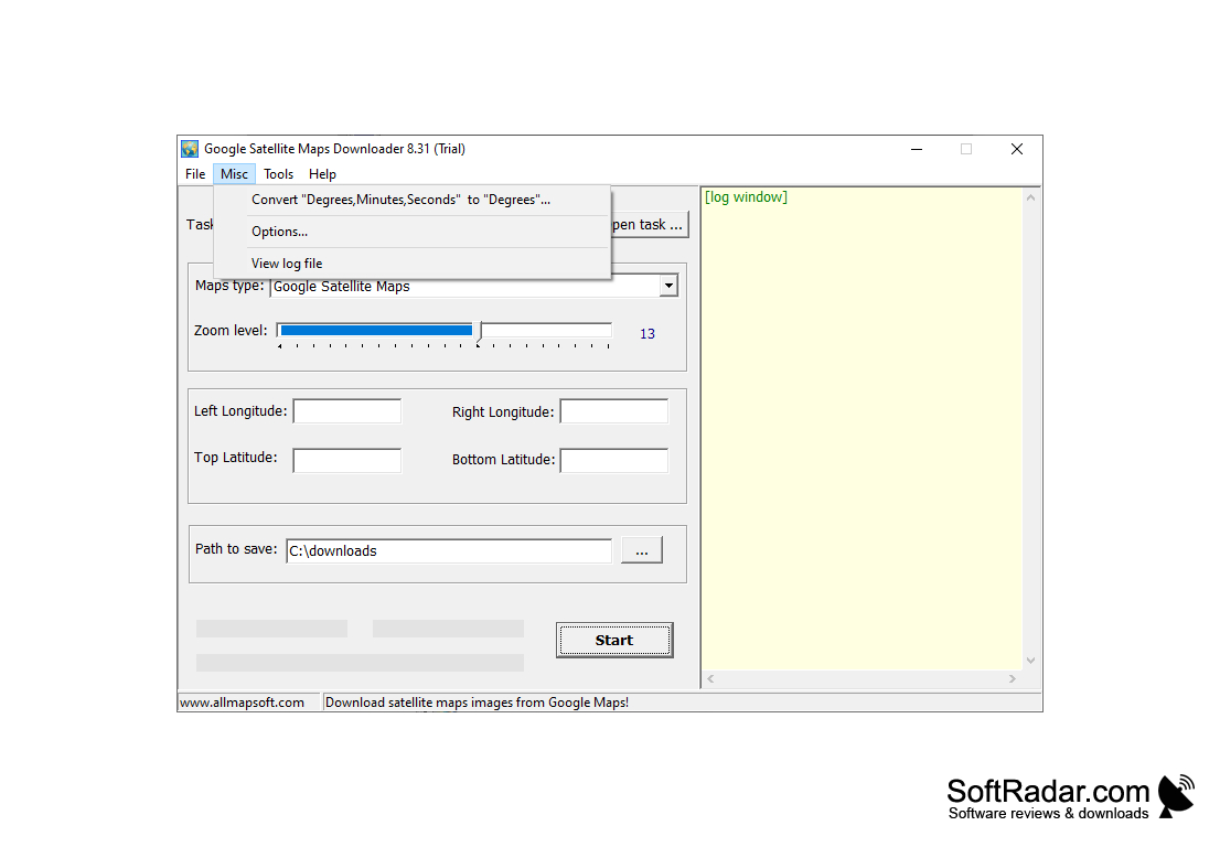
  • Provides the Coordinates Converter tool
  • Supports Windows XP/Vista/7/8/10 with 32/64-bit systems
  • Zooming support for the precision of the location's image

Google Satellite Maps Downloader is very fast and extremely easy to use symbolizing the perfect tool for quickly retrieving satellite images. The Maps Downloader's typical download duration for a square degree map is approximately a minute while the merger and integration of the download images with the previous images take approximately a few seconds. While files are downloaded in JPG/JPEG format, the image viewer is used to view these downloaded image files in a thorough and fully comprehensible manner.

Another feature worthy of the note is the archiving ability of the downloader. This means that the images are arranged and archived for a better view. As part of the download manager functions, multiple threads of images can be retrieved. As for items that are not being able to be retrieved, their information is saved in a log and can be retrieved at a future date for download.

Finally, the use of Google Satellite Maps Downloader on Windows PC is not tasking at all, uses limited or little resources, and does not affect the performance and functionality of other operations of the computer system. The Google Satellite Maps Downloader is shareware for multiple platforms and its demo is readily accessible to all users. With the free version, there exist some restrictions which are present in the full version.

It provides access to google map images at any time either while online or offline.


Windows XP/Vista/7/8/10 with 32/64-bit systems support
Internet connection for downloading images
The ability to view JPG/JPEG format
Sufficient storage for image archiving

PROS
Easy to download high-resolution satellite images.
Supports batch downloads for efficiency.
Allows conversion of images to other formats.

CONS
Some areas are blurred or pixelated for privacy and security reasons.
Does not update satellite images frequently.
Limited functionality compared to other similar software.
image/svg+xmlBotttsPablo Stanleyhttps://bottts.com/Florian Körner Jon Boy
This looks like it would be an awesome idea for having on a smartphone or in your car (android auto, etc). I am not sure of exactly how functional it would be for use on a PC or laptop, as you may or may not always have those items on your person at all times.
image/svg+xmlBotttsPablo Stanleyhttps://bottts.com/Florian Körner sam dow
It provides access to google map images at any time either while online or offline.
image/svg+xmlBotttsPablo Stanleyhttps://bottts.com/Florian Körner James
It did not open the program when I tried to log in. not a good experience and I did not like the way it looks, however, It does not mean that It does not work. I am not a big fun of it.
image/svg+xmlBotttsPablo Stanleyhttps://bottts.com/Florian Körner Oscar Haddad
Google Satellite Maps Downloader for Windows allows the user to download specific satellite photos from google's extensive reserve of data. The program lets you tailor your image zoom levels to your preferences and lets you download the high resolution files to your device. From there you are able to manipulate the pictures in whatever map making or photo editing software you desire.
image/svg+xmlBotttsPablo Stanleyhttps://bottts.com/Florian Körner Sean
Google Satelite is a well know and very great software and tool for all device types and programs that to map and pin directions and recurve old photos of property this program is specifically meant for the windows and to easily run the Android software on your Windows device easily.
image/svg+xmlBotttsPablo Stanleyhttps://bottts.com/Florian Körner Angus
Google Satellite Maps Downloader is a great program to have if you want to obtain the satellite images that Google Maps has. The tool keeps and stores all of those images. There are two ways that you can view those images - either in the Map Viewer, or in a combined map. The program offers various file formats for the combined map.
image/svg+xmlBotttsPablo Stanleyhttps://bottts.com/Florian Körner Jay
I love using Google Satellite Maps Downloader for Windows because this program makes it a cinch to download and save any satellite map I want directly from the Google Maps platform to my computer. By doing so, I can access those maps even when my device isn't hooked up to the Internet. I love that I can view maps from every corner of the globe on demand.
image/svg+xmlBotttsPablo Stanleyhttps://bottts.com/Florian Körner Tyler
Google Satellite Maps Downloader is a useful tool if you are trying to obtain multiple satellite images of different locations, especially if you are not going to have a reliable internet connection. It is especially useful if you are working with coordinates. It is not as user friendly as google maps but will automatically save the satellite image so you do not have to screenshot or crop a google maps image.
image/svg+xmlBotttsPablo Stanleyhttps://bottts.com/Florian Körner Christopher
FROM THE OFFICIAL PAGE OF GOOGLE MAP WE CAN DOWNLOAD THE SATELLITE MAPS USING THIS GOOGLE SATELLITE DOWNLOADER EVEN AT NO INTERNET SITUATION YOU MAY ACCESS IT. USING IT YOU CAN SEE ANY PART OF THE WORLD IN MAP AND SAVE THAT PICTURE BY DOWNLOADING IT.
image/svg+xmlBotttsPablo Stanleyhttps://bottts.com/Florian Körner John
Google Satellite Maps Downloader For Windows is a best application software. By using google maps we get a satellite image tat contains small image. It is very easy to view a map from anywhere and also it saves in your mobile or drive. The routes are very good in quality so that you can easily reach your destination. You can also zoom the images. You can easily download the images that saves JPG/JPEG format.
image/svg+xmlBotttsPablo Stanleyhttps://bottts.com/Florian Körner Jamie Dalporto
Satellite Maps Downloader is software that enables users to download satellite images from Google Maps. The software allows users to save the images to their PCs so they can be used for various purposes, such as research, planning, presentations, and others. The software also enables users to choose the area they want to download, the resolution of the images, the file format, and the download method. The software is easy to use and comes with a step-by-step guide to help users get started.
image/svg+xmlBotttsPablo Stanleyhttps://bottts.com/Florian Körner Brodie Roadarmel
I recently used Google Satellite Maps Downloader software to download satellite images and was quite impressed with the results. It was very easy to navigate and the download process was very quick. The software also gave me the option to adjust the resolution and size of the image, which was great. The quality of the images was very high, which was fantastic. Additionally, the software provided me with the ability to create a mosaic of the images I had downloaded, which was really useful. The interface was also very user friendly and I found it very easy to use. Overall, I found Google Satellite Maps Downloader to be a great piece of software.
image/svg+xmlBotttsPablo Stanleyhttps://bottts.com/Florian Körner Jacob Koether
1. Google Satellite Maps Downloader is an easy-to-use software to download satellite images. 2. The graphical user interface is intuitive and straightforward. 3. It supports a variety of image formats. 4. There are a lot of options to customize the download. 5. The download speed is fast.
image/svg+xmlBotttsPablo Stanleyhttps://bottts.com/Florian Körner Jack K.
The Google Satellite Maps Downloader sotfware is fairly easy to use and the download speeds are decent. However, the UI could be improved as it is a bit clunky and unintuitive.
image/svg+xmlBotttsPablo Stanleyhttps://bottts.com/Florian Körner Charlie D.
Google Satellite Maps Downloader is a useful software that allows users to download satellite maps from Google Maps for offline viewing. The interface is user-friendly and the download speed is fast.
image/svg+xmlBotttsPablo Stanleyhttps://bottts.com/Florian Körner Callum Mahiai
Google Satellite Maps Downloader is a software that allows users to download satellite images from Google Maps for offline viewing.
image/svg+xmlBotttsPablo Stanleyhttps://bottts.com/Florian Körner Fraser
Google Satellite Maps Downloader is a convenient tool that enables users to download satellite images from the Google Maps service. This software's predominant feature is its ability to accumulate small images into a larger composite picture. It offers high-resolution satellite imagery and includes options to specify latitude and longitude coordinates, making it ideal for professionals working in geography-related fields.
image/svg+xmlBotttsPablo Stanleyhttps://bottts.com/Florian Körner Riley
A simple tool to download high-resolution satellite images with a little bit of learning curve.
image/svg+xmlBotttsPablo Stanleyhttps://bottts.com/Florian Körner Arran
Efficient, excellent zoom feature, occasional download errors.
image/svg+xmlBotttsPablo Stanleyhttps://bottts.com/Florian Körner Kai
Easy to use, detailed imagery.
Envisioneer Express
A view and markup tool to aid in creating and designing rooms.
Affinity Photo
A professional photo editing software for Windows
PowerGUI
Work with Powershell smoothly
AirServer
A multi-device mirroring receiver for Windows 10 Desktop
k2pdfopt
It helps convert pdf files on mobile devices