GPlates Portable
by GPlates Development Team
GPlates Portable is a free, open-source, cross-platform software application for the interactive visualization of plate-tectonics reconstructions and associated geological and paleo-geographic features through geological time.
Operating system: Windows
Publisher: GPlates Development Team
Release : GPlates Portable 1.5.0
Antivirus check: passed
GPlates Portable is a powerful and versatile software application designed to facilitate the manipulation and visualization of digital geological and paleogeographic data. Developed by GPlates, the application provides a comprehensive suite of features to help users analyze and interpret the Earth's geological history and present day tectonics.
The application is built on an open source architecture and is suitable for use in both professional and educational contexts. GPlates Portable is designed to be platform independent, enabling users to work with data from any platform, including Windows, Mac and Linux.
GPlates Portable offers a comprehensive suite of features to help users analyze and interpret the Earth's geological history and present day tectonics.
• Plate Reconstruction Tools: GPlates Portable provides a suite of powerful plate reconstruction tools that enable users to explore the Earth's geological history at any point in time. Using the software's sophisticated algorithms, users can rotate and scale plates and reconstruct the Earth's surface for any given time period.
• Plate Tectonic Modeling: GPlates Portable includes advanced tools for modeling plate tectonics. Users can create and manipulate a variety of tectonic models, including Divergent, Convergent, Transform and Strike Slip boundaries, as well as Hotspots and Subduction zones.
• Geological Data Analysis: GPlates Portable includes tools for analyzing geological data, such as sedimentary basins, volcanoes, and fault systems. The software can be used to identify trends in the data, as well as to predict future tectonic activity.
• Paleogeography: GPlates Portable provides a comprehensive suite of features for analyzing and visualizing paleogeography. Users can create detailed reconstructions of the Earth's surface at any point in time, as well as explore the Earth's climate and environment over the course of its history.
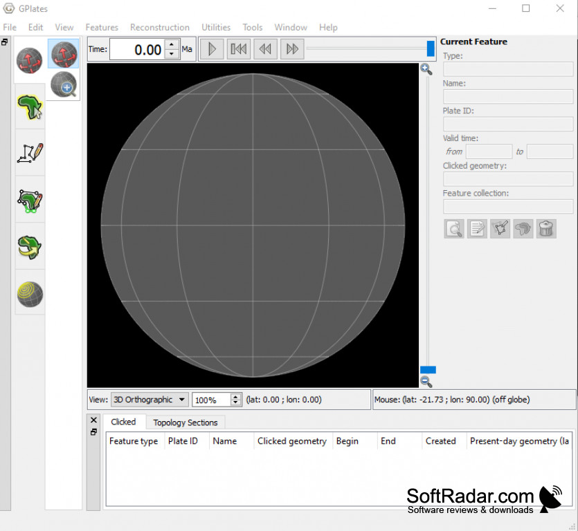
• Visualization: GPlates Portable includes a variety of visualization tools for creating detailed maps and images. The software supports a range of GIS formats and can be used to generate 3D animations and interactive web maps.
• Advanced Analysis Tools: GPlates Portable includes a suite of advanced analysis tools for exploring plate tectonics and geological data. The software can be used to generate reports and simulations, as well as to analyze the effects of tectonic activity on the Earth's surface over time.
• Collaboration: GPlates Portable includes features for collaborating with other users. The software supports team projects and facilitates communication between users.
• Support: The application includes comprehensive documentation and a range of tutorials to help users get started. Additionally, GPlates Portable includes a built-in support system to assist users with any technical issues they may encounter.
The application is built on an open source architecture and is suitable for use in both professional and educational contexts. GPlates Portable is designed to be platform independent, enabling users to work with data from any platform, including Windows, Mac and Linux.
GPlates Portable allows users to explore and manipulate geospatial data within a 3D virtual globe environment.Features:
GPlates Portable offers a comprehensive suite of features to help users analyze and interpret the Earth's geological history and present day tectonics.
• Plate Reconstruction Tools: GPlates Portable provides a suite of powerful plate reconstruction tools that enable users to explore the Earth's geological history at any point in time. Using the software's sophisticated algorithms, users can rotate and scale plates and reconstruct the Earth's surface for any given time period.
• Plate Tectonic Modeling: GPlates Portable includes advanced tools for modeling plate tectonics. Users can create and manipulate a variety of tectonic models, including Divergent, Convergent, Transform and Strike Slip boundaries, as well as Hotspots and Subduction zones.
• Geological Data Analysis: GPlates Portable includes tools for analyzing geological data, such as sedimentary basins, volcanoes, and fault systems. The software can be used to identify trends in the data, as well as to predict future tectonic activity.
• Paleogeography: GPlates Portable provides a comprehensive suite of features for analyzing and visualizing paleogeography. Users can create detailed reconstructions of the Earth's surface at any point in time, as well as explore the Earth's climate and environment over the course of its history.
• Visualization: GPlates Portable includes a variety of visualization tools for creating detailed maps and images. The software supports a range of GIS formats and can be used to generate 3D animations and interactive web maps.
• Advanced Analysis Tools: GPlates Portable includes a suite of advanced analysis tools for exploring plate tectonics and geological data. The software can be used to generate reports and simulations, as well as to analyze the effects of tectonic activity on the Earth's surface over time.
• Collaboration: GPlates Portable includes features for collaborating with other users. The software supports team projects and facilitates communication between users.
• Support: The application includes comprehensive documentation and a range of tutorials to help users get started. Additionally, GPlates Portable includes a built-in support system to assist users with any technical issues they may encounter.
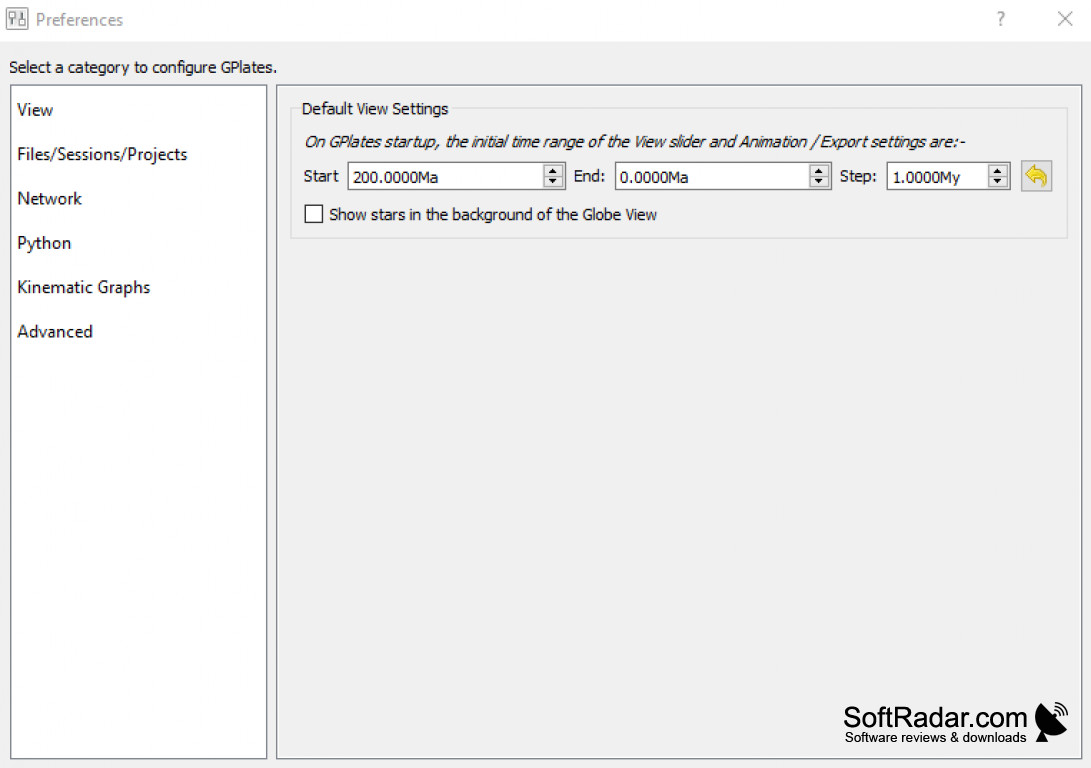
GPlates Portable is a powerful 3D geological visualization platform, designed to run on most Windows, Mac, and Linux systems. It requires a modern computer with at least 2GB of RAM, an OpenGL video card, and an internet connection. The software can be installed on a USB stick or other external drive, or it can be run in a web browser. Additionally, GPlates Portable requires a compatible web browser such as Chrome, Firefox, or Safari.
PROS
Allows interactive visualization of plate-tectonics data and models.
Can be used without installation on any computer.
Supports various data formats and sophisticated functions.
Can be used without installation on any computer.
Supports various data formats and sophisticated functions.
CONS
Limited functionality compared to some full-fledged GIS software.
The user interface may seem complex for beginners.
Lacks extensive online tutorial or user support.
The user interface may seem complex for beginners.
Lacks extensive online tutorial or user support.
Aidan I******q
GPlates Portable is a convenient way to view geological plate reconstructions in 3D. The software is highly user-friendly, with a great user interface. The maps are visually appealing, and the ability to rotate the plates is a great feature. It offers a variety of different plate configurations which is great for analysis. The 3D view is useful for making comparisons between different plates. The scale bar and color options are also helpful. I have found the software to be reliable and have not experienced any major issues with it.
Kai P********e
GPlates Portable software is really interesing and useful. I have been using it for some time now and it has been very helpful. It's great that it is portabble which makes it very convenient to use. Unfortunatelly, it can be a bit difficult to navigate sometimes and the interface is not always clear. But overral, it is a great tool.
Harrison Kenser
GPlates Portable is a free and open-source software that allows users to visualize and analyze the Earth's plate tectonics. It supports the reconstruction of past plate configurations, the calculation of plate motion, and the visualization of geological and geophysical data. The software is designed to be portable across different operating systems and can be run from a USB drive without installation. GPlates Portable is widely used by geoscientists, researchers, and educators for teaching and research purposes. It offers an intuitive user interface and various customization options to suit different needs.
Muhammad Gierl
GPlates Portable software is a user-friendly and intuitive tool for visualizing and analyzing geological data.
John
Intuitive interface, excellent for visualizing tectonic movements.
Reuben
Innovative, user-friendly tectonic reconstruction tool.
Christopher
This is a robust and versatile software application, specially designed to facilitate the manipulation and visualization of digital geological and paleogeographic data. This application provides a complete range of features that assist the user in the analysis and interpretation of the Earth's geological history and current tectonics.
It is built on an open-source architecture, which makes it suitable for both professional and educational contexts. Additionally, it is designed to be platform-independent, allowing users to work with data from any platform, including Windows, Mac, or Linux.
The wide variety of tools it offers, ranging from plate tectonic modeling to geological data analysis, as well as paleogeographic visualization and analysis, make it an essential tool for anyone interested in the history of our planet. Furthermore, it provides collaboration tools to facilitate teamwork and communication among users.