MapTiler
by Klokan Petr Pridal
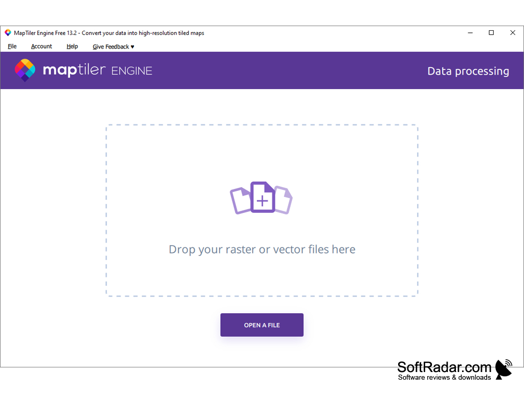
MapTiler is a software for creating custom maps from various sources, such as raster images, vector data, and online sources.
MapTiler
MapTiler is a powerful and easy-to-use software for quickly and easily creating interactive maps from your geodata. It enables you to take your geographic data, such as GIS shapefiles, GeoJSON files, digital elevation models (DEMs), raster images, and more, and turn them into interactive, web-based maps. With MapTiler, you can easily create interactive maps for websites, web applications, mobile applications, and even printed maps.
● Support for a wide range of geodata formats, including GIS shapefiles, GeoJSON, digital elevation models (DEMs), raster images, and more
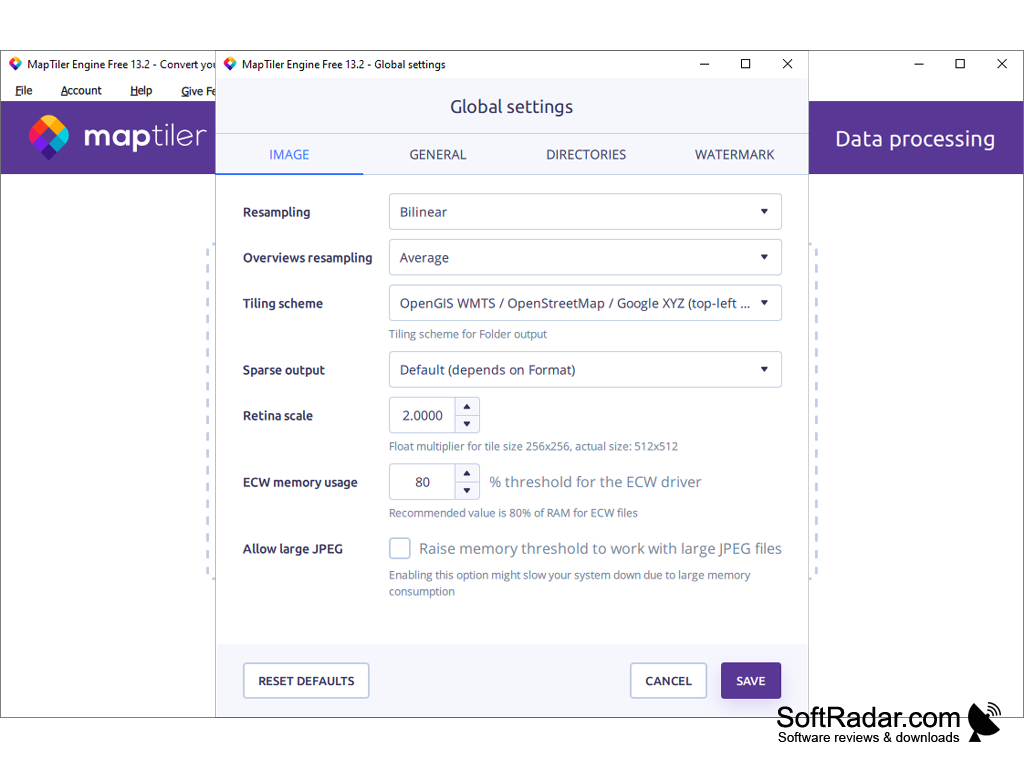
● Ability to customize the appearance of your maps with advanced styling options, such as color and layer blending, line widths, labels, and more
● Generate interactive, web-based maps with drag-and-drop functionality
● Create custom map tiles for offline use or for embedding in webpages and applications
● Support for high-resolution printing (up to 100 megapixels)
● Built-in tools for creating and managing markers, lines, and polygons
● Export your maps and data in a variety of formats, including JPEG, PNG, PDF, GeoTIFF, and more
● Ability to add annotations and notes to your maps
● Connect with third-party services, such as Google Maps and OpenStreetMap
● Automatically generate KML and GeoJSON files
● Create interactive slippy maps with custom layers
● Share your maps with others via email, social media, and more
● Optimize your maps for faster loading and smoother user experience
● Easy-to-use user interface and comprehensive documentation
● Free and open source software
MapTiler is the perfect tool for creating interactive maps for webpages, web applications, and mobile applications. With its intuitive user interface and powerful features, you can quickly and easily create custom maps that look great and perform well. Whether you’re an experienced GIS user or a beginner, MapTiler is the perfect solution for quickly and easily creating interactive maps.
MapTiler is a powerful and easy-to-use software for quickly and easily creating interactive maps from your geodata. It enables you to take your geographic data, such as GIS shapefiles, GeoJSON files, digital elevation models (DEMs), raster images, and more, and turn them into interactive, web-based maps. With MapTiler, you can easily create interactive maps for websites, web applications, mobile applications, and even printed maps.
MapTiler makes it easy to create custom, interactive maps with any data set.Features:
● Support for a wide range of geodata formats, including GIS shapefiles, GeoJSON, digital elevation models (DEMs), raster images, and more
● Ability to customize the appearance of your maps with advanced styling options, such as color and layer blending, line widths, labels, and more
● Generate interactive, web-based maps with drag-and-drop functionality
● Create custom map tiles for offline use or for embedding in webpages and applications
● Support for high-resolution printing (up to 100 megapixels)
● Built-in tools for creating and managing markers, lines, and polygons
● Export your maps and data in a variety of formats, including JPEG, PNG, PDF, GeoTIFF, and more
● Ability to add annotations and notes to your maps
● Connect with third-party services, such as Google Maps and OpenStreetMap
● Automatically generate KML and GeoJSON files
● Create interactive slippy maps with custom layers
● Share your maps with others via email, social media, and more
● Optimize your maps for faster loading and smoother user experience
● Easy-to-use user interface and comprehensive documentation
● Free and open source software
MapTiler is the perfect tool for creating interactive maps for webpages, web applications, and mobile applications. With its intuitive user interface and powerful features, you can quickly and easily create custom maps that look great and perform well. Whether you’re an experienced GIS user or a beginner, MapTiler is the perfect solution for quickly and easily creating interactive maps.
For MapTiler software, the following technical requirements need to be met:
• Operating System: Windows 10 or higher, macOS 10.13 or higher
• Graphics card: Nvidia or AMD with at least 2GB of dedicated video memory
• RAM: 4GB or more
• Disk Space: 500MB or more
• Processor: Intel Core i5 or higher
• Internet connection: Broadband or equivalent
• Operating System: Windows 10 or higher, macOS 10.13 or higher
• Graphics card: Nvidia or AMD with at least 2GB of dedicated video memory
• RAM: 4GB or more
• Disk Space: 500MB or more
• Processor: Intel Core i5 or higher
• Internet connection: Broadband or equivalent
PROS
Supports a wide range of geographical data format conversion.
Offers customizable map design tools for unique outputs.
Includes fast cloud-based map rendering and optimization.
Offers customizable map design tools for unique outputs.
Includes fast cloud-based map rendering and optimization.
CONS
Limited customization options compared to other mapping software.
Requires a steep learning curve for beginners.
Expensive pricing plans for advanced features.
Requires a steep learning curve for beginners.
Expensive pricing plans for advanced features.