GPS NMEA Visualizer
by Pier-Luc Duchaine
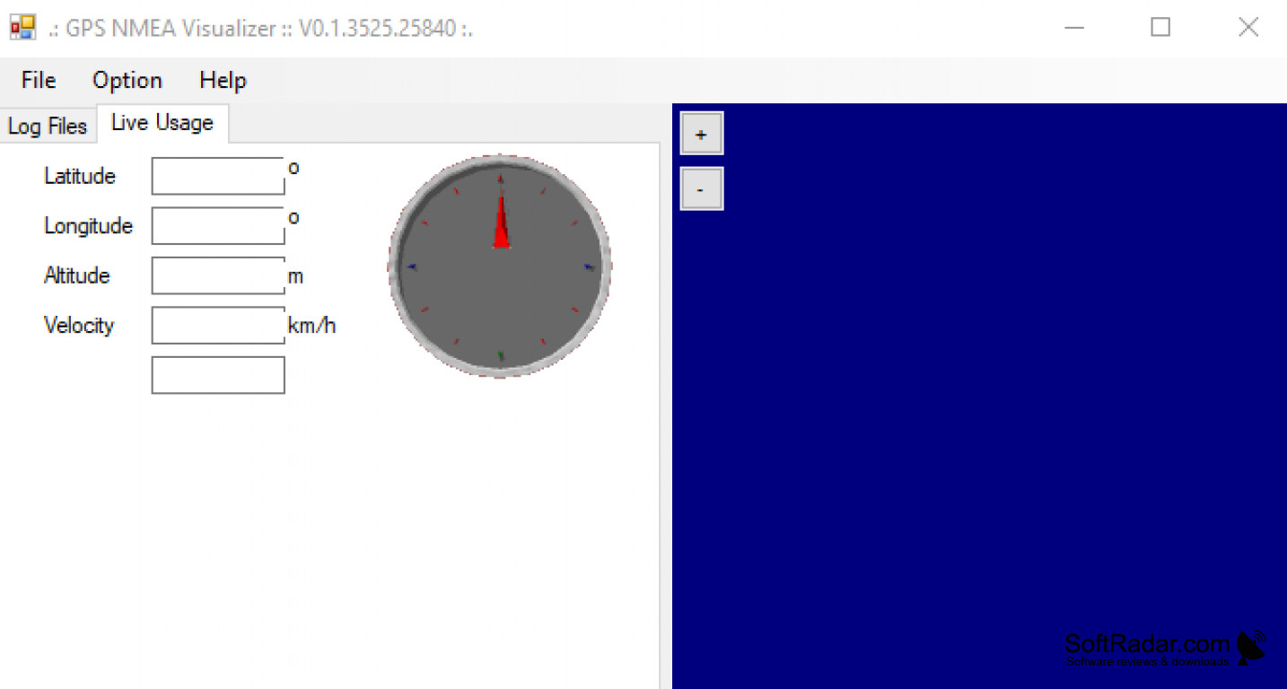
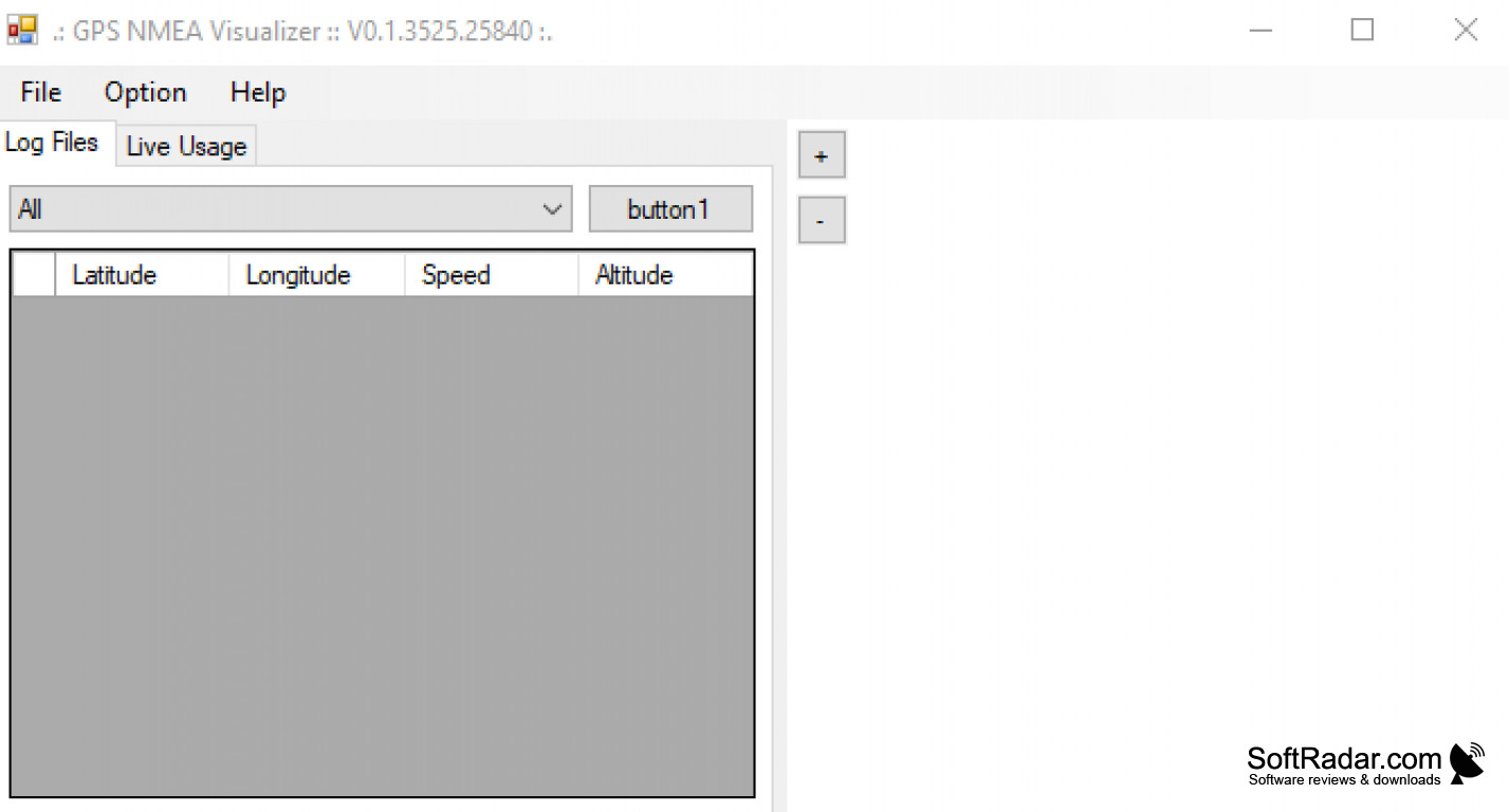
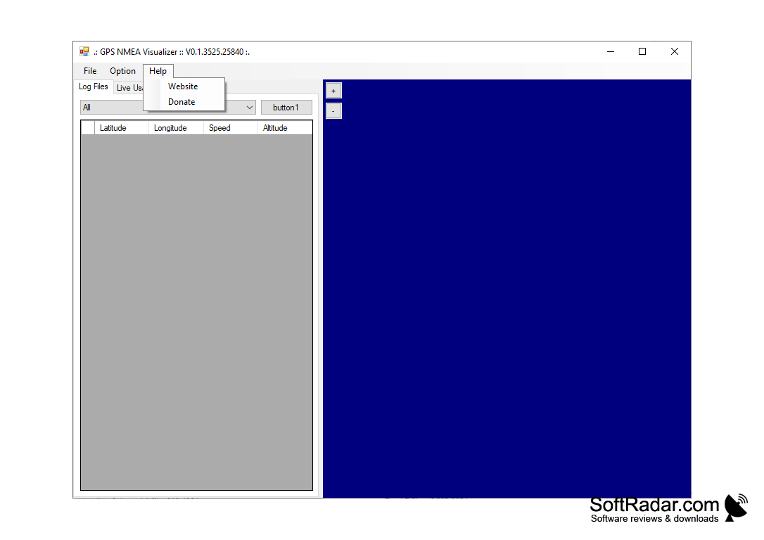
GPS NMEA Visualizer is an interactive graphical tool for displaying and analyzing real-time GPS NMEA data.
Operating system: Windows
Publisher: Pier-Luc Duchaine
Release : GPS NMEA Visualizer 0.1
Antivirus check: passed
GPS NMEA Visualizer
GPS NMEA Visualizer is a revolutionary software solution designed to help users visualize and analyze GPS data in real time. The software is designed to display GPS data in a graphical way, allowing users to quickly identify trends, patterns, and anomalies in the data.
GPS NMEA Visualizer is an intuitive and easy to use software solution designed to display GPS data in an easy to understand graphical way. The software has a wide range of features and functions, allowing users to easily and quickly visualize and analyze the data.
• Real-time visualization and analysis of GPS data
• Graphical display of GPS data
• Ability to zoom in and out of the data
• Support for multiple data sources
• Ability to filter data by time and type
• Ability to export data to various formats
• Support for multiple languages and user interfaces
• Detailed data analysis and reporting
• Ability to create custom reports and visualizations
• Support for multiple map types
• Ability to customize the map and add notes
• Ability to share data with other users
• Ability to add annotations to the map
• Ability to link to external databases
• Integration with other GPS data visualization tools
• Support for tracking multiple devices
• Ability to run in the background
• Ability to send notifications
• Support for multiple users
• Ability to monitor and set alerts
• Integration with a wide range of GPS devices
• Secure connection and data encryption
• 24/7 customer support
The software is designed to be easy to use and understand, and it provides users with the tools and features they need to quickly and accurately analyze and visualize GPS data. With its intuitive user interface, GPS NMEA Visualizer makes it easy for users to quickly identify trends, patterns, and anomalies in the data.
GPS NMEA Visualizer is the ideal solution for anyone who needs to analyze and visualize GPS data in real time. With its powerful features and intuitive design, the software makes it easy for users to quickly and accurately analyze and visualize GPS data.
GPS NMEA Visualizer is a revolutionary software solution designed to help users visualize and analyze GPS data in real time. The software is designed to display GPS data in a graphical way, allowing users to quickly identify trends, patterns, and anomalies in the data.
GPS NMEA Visualizer is an intuitive and easy to use software solution designed to display GPS data in an easy to understand graphical way. The software has a wide range of features and functions, allowing users to easily and quickly visualize and analyze the data.
The GPS NMEA Visualizer allows users to quickly and easily visualize and analyze GPS data.Features:
• Real-time visualization and analysis of GPS data
• Graphical display of GPS data
• Ability to zoom in and out of the data
• Support for multiple data sources
• Ability to filter data by time and type
• Ability to export data to various formats
• Support for multiple languages and user interfaces
• Detailed data analysis and reporting
• Ability to create custom reports and visualizations
• Support for multiple map types
• Ability to customize the map and add notes
• Ability to share data with other users
• Ability to add annotations to the map
• Ability to link to external databases
• Integration with other GPS data visualization tools
• Support for tracking multiple devices
• Ability to run in the background
• Ability to send notifications
• Support for multiple users
• Ability to monitor and set alerts
• Integration with a wide range of GPS devices
• Secure connection and data encryption
• 24/7 customer support
The software is designed to be easy to use and understand, and it provides users with the tools and features they need to quickly and accurately analyze and visualize GPS data. With its intuitive user interface, GPS NMEA Visualizer makes it easy for users to quickly identify trends, patterns, and anomalies in the data.
GPS NMEA Visualizer is the ideal solution for anyone who needs to analyze and visualize GPS data in real time. With its powerful features and intuitive design, the software makes it easy for users to quickly and accurately analyze and visualize GPS data.


1. Operating System: Windows 7 or higher, Mac OS X 10.9 or higher, or Linux with a compatible X Window System
2. Processor: Intel Pentium 4 or higher
3. Memory: 1 GB RAM
4. Hard Drive: 10 GB of free space
5. Internet Connection: Broadband connection
6. Software: Microsoft .NET Framework 4.5 or higher, Mono Framework 3.2 or higher
7. Graphics: DirectX 9 compatible video card with 256 MB of video RAM
8. Other: GPS receiver with NMEA data output and NMEA data cable
PROS
Provides real-time visualization of NMEA data.
User-friendly interface with intuitive control.
Supports multiple data formats and devices.
User-friendly interface with intuitive control.
Supports multiple data formats and devices.
CONS
May experience delays in data visualization.
Lacks advanced analytic capabilities.
Interface is not user-friendly.
Lacks advanced analytic capabilities.
Interface is not user-friendly.