Microsoft MapPoint

Compile data from multiple sources to your maps

Operating system: Windows

Antivirus check: passed

Report a Problem

Microsoft MapPoint is a versatile program that allows its users to plan trips, customize driving routes, and much more. This program is so diverse that Microsoft doesn't even have a good description of the program. Microsoft MapPoint isn't just another program that allows you to view maps. It will enable you to edit them in any way you wish entirely. Business people can map out their customer base, revenue earnings, truck routes, and everything in-between. The average person traveling can plot out their entire journey, print it out on paper, or transfer it to their GPS device. The possibilities are almost limitless to what you can perform with this software.

Features:

  • Make Customized GPS Routes
  • Free Software & Upgrades
  • Multiple Regions Available
  • Can Be Used With Office, Excel, SQL & PowerPoint

When people see this program, the first thing that usually comes to mind is that this was an older version of Google Maps and is now obsolete. However, this is not the case with Microsoft MapPoint. The software is an untapped source for heavy map customization that can be utilized by anyone from big corporations to a single person planning a family vacation.

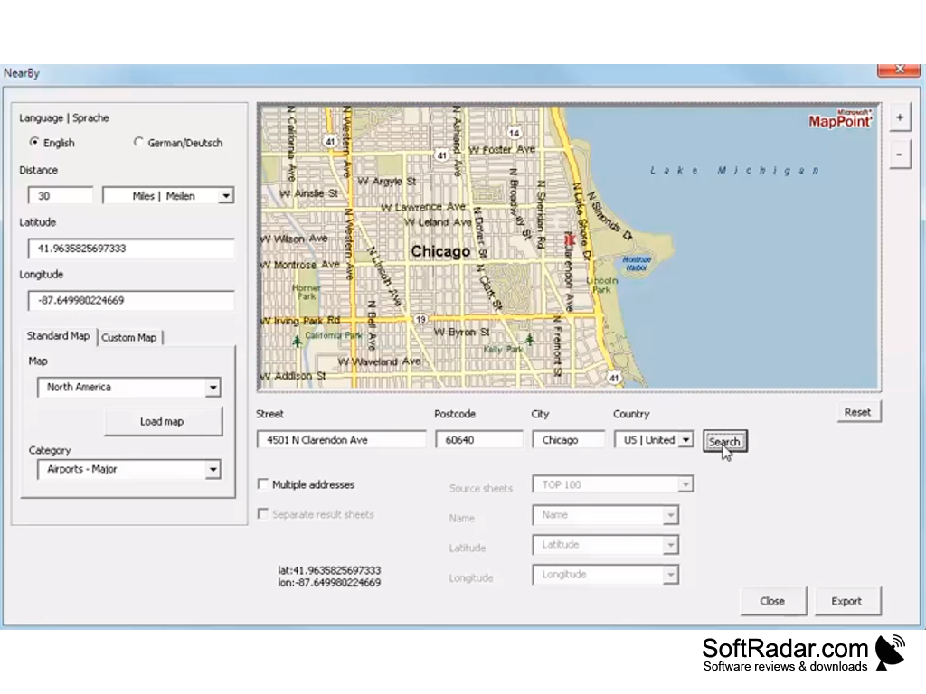
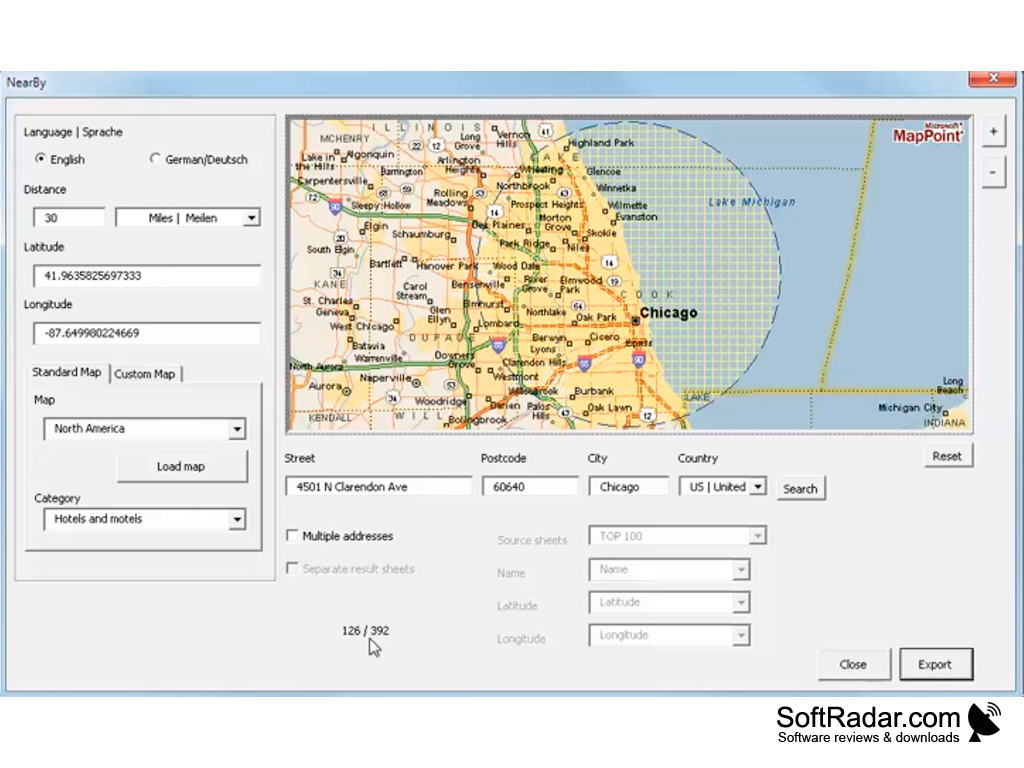
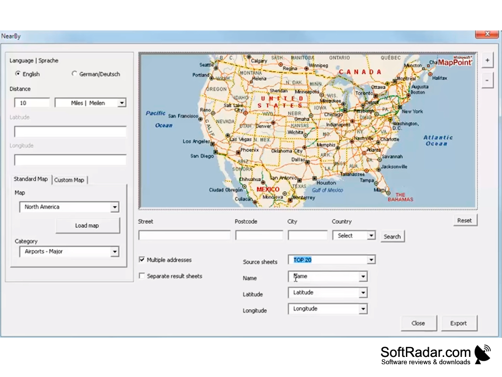
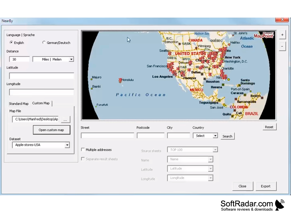
Microsoft MapPoint is a map integration software that allows you to view, edit, and integrate maps

Obviously, this software is better suited for major companies since they can use a lot of hidden features. Being able to track things like revenue streams, driving routes, and many other things are too good to pass up. The really impressive thing about the program is the fact that it is compatible with all of Microsoft's applications.

If someone wanted to, they could use PowerPoint in conjunction with Microsoft MapPoint to create a professional presentation of the most commonly used roads in the area. When it comes to single person use, I doubt that all the bells and whistles will ever be used. Dare I say Google Maps would be a simpler way to navigate, but if you use a GPS, this program will benefit you more. You can create your own GPS routes and add them to your device without the need to buy an updated map from the company.

Windows Operating System (XP, Vista, Windows 7,8,10)
1 GHz Processor or faster
1 GB RAM for 32-bit OS, 2 GB for 64-bit OS
3 GB of available hard disk space

PROS
Highly detailed maps with extensive geographical information.
Easily integrates with Microsoft Office applications.
Customizable points-of-interest and routing options.

CONS
Not regularly updated, so may contain outdated geographical information.
Complex interface can be difficult to navigate for beginners.
Lack of mobile app support restricts on-the-go access.

Ryan
Wed, Jan 17, 2024

Do you love traveling? Do you usually plan your trips step-by-step? If you want to make this process faster and easier, check out Microsoft MapPoint.

The app helps users plan their trips, driving routes, and more. The program has lots of useful features. You can view and edit maps, transfer your entire journey to your GPS device, and even more. Users especially like the fact that the app is compatible with all of Microsoft's applications. Also, they find the maps displayed by the app highly detailed, with extensive geographical information.
Unfortunately the app doesn’t get constant updates.
image/svg+xmlBotttsPablo Stanleyhttps://bottts.com/Florian Körner Hamish
One thing I noticed right off the bat was that "integration" is misspelled in the quotation. I think that this is a poor description. I see no benefit for regular people using this program for planning trips over more popular apps such as google maps or waze, which offer the same features they would likely be interested in and are also available on mobile platforms. Because of this, I do not think it is even worth advertising to regular people and that this software should focus on major companies. I think that the customer base and revenue earning tools are unique features not offered by other competitors and that the software does a poor job advertising to these people when it doesnt even list them under the bulleted features.
image/svg+xmlBotttsPablo Stanleyhttps://bottts.com/Florian Körner Theo
Microsoft Mappoint was released in 2000 and then discontinued in 2014. You are still able to download and use Microsoft Mappoint but unfortunately there is no support available from Windows anymore. Microsoft Mappoint is an alternative to Google Maps and also Bing Maps. It is very easy to use and is designed for all types of usages. However Mappoint is no longer available for free and has to be purchased. It created the mapping platform which was subsequently used by other geographical information systems (or mapping) software. It is recommended as an alternative to the other solutions available in the marketplace but is currently seldom used. The latest version available for download is from 2013.
image/svg+xmlBotttsPablo Stanleyhttps://bottts.com/Florian Körner Alfie
The MapPoint software is thoroughly backed by software behemoth Microsoft. It has unique offline facility useful for all the sense and purpose of using visual maps for a business user like me who is always on move and have limited internet fictionality on my phone. The maps are periodically updated and best of all any feedback submitted in a GIS location is immediately addressed by Microsoft top notch support.
image/svg+xmlBotttsPablo Stanleyhttps://bottts.com/Florian Körner Finn
Microsoft MapPoint for windows was great edit and view geographical analysis data. It was used to mainly identify the visualization map point for geographical. I am very glad to say this software was huge used with the my geographical new area journey.
image/svg+xmlBotttsPablo Stanleyhttps://bottts.com/Florian Körner Max
I love using Microsoft MapPoint for Windows because this program makes mapping a cinch. It's compatible with Microsoft Office, which means you can easily create maps that work well with Microsoft Excel. I appreciate the abundance of mapping tools that it offers, including but not limited to the legends, the boundaries and the zoom function to see details in maps up close.
image/svg+xmlBotttsPablo Stanleyhttps://bottts.com/Florian Körner Blair Heininger
Microsoft MapPoint is a software program used for creating and analyzing maps. It allows users to view, analyze, and present data on a map. MapPoint includes tools for creating custom maps, displaying route information, tracking vehicle routes, and analyzing data. It also offers integration with other Microsoft products, such as Excel and Access.
image/svg+xmlBotttsPablo Stanleyhttps://bottts.com/Florian Körner Noah Davanzo
Microsoft MapPoint is a powerful software to help you get around, plan a trip, and analyze data. It has an intuitive user interface that makes it easy to use. The maps are detailed and up-to-date. I especially like the route planner feature which calculates the best route to take. It also gives you the option to add stops along your route. I also like that you can add your own data to the maps. You can also customize the maps to fit your needs. The maps also provide real-time traffic information so you can avoid traffic jams. Overall, the software is great for anyone who needs to plan a trip or analyze data.
image/svg+xmlBotttsPablo Stanleyhttps://bottts.com/Florian Körner David A*******i
Microsoft MapPoint software is a powerful and comprehensive mapping tool. It has a comprehensive range of features, including route planning, customised maps and data visualisation. The user interface is intuitive and the maps are easy to customise. The software is also easy to use when calculating distances between points. However, some of the features can be a bit slow to load.
image/svg+xmlBotttsPablo Stanleyhttps://bottts.com/Florian Körner Robbie Kitting
Microsoft MapPoint is a great software for creating maps and getting directions, however it can be a bit cumbersom to set up and use at times.
image/svg+xmlBotttsPablo Stanleyhttps://bottts.com/Florian Körner Aaron H******c
Microsoft MapPoint was a great tool for plannig out routes, but it was a bit glitchy at times and somtimes crashed unexpectedly.
image/svg+xmlBotttsPablo Stanleyhttps://bottts.com/Florian Körner Rhys Shuping
Microsoft MapPoint was a useful software for creating maps and analyzing data, but its discontinuation in 2014 has left many users searching for alternative solutions.
image/svg+xmlBotttsPablo Stanleyhttps://bottts.com/Florian Körner Christopher Began
Microsoft MapPoint software is a mapping and geographic data visualization tool that allows users to create custom maps and analyze data based on location.
image/svg+xmlBotttsPablo Stanleyhttps://bottts.com/Florian Körner Freddie
Microsoft MapPoint is a versatile software, primarily designed for business data visualization on maps. Its key feature is its geographical mapping tool, which seamlessly integrates with Microsoft Office applications. It allows users to generate comprehensive maps, manipulate geographic data, and analyze information related to specific locations. Another critical aspect is its data analysis feature, which effectively facilitates strategic decision making.
image/svg+xmlBotttsPablo Stanleyhttps://bottts.com/Florian Körner Jack
Loved the comprehensive mapping tools, but struggled with the occasional system crashes.
image/svg+xmlBotttsPablo Stanleyhttps://bottts.com/Florian Körner Ryan
Versatile tool, outdated interface, accurate geographical data representation.
Emma
Good for finding places but directions are sometimes wrong.
Fractal Mapper
An integrated mapping system to help gamers create a wide variety of maps
Garmin MapInstall
Seamlessly update your maps on your Garmin devices
ExpertGPS
A mapping software for Mapping Data Downloading
Seterra
A geography teaching software for Windows
StatPlanet
StatPlanet programming empowers you to outwardly investigate every one of your information inside a solitary natural